Today’s California Treasure – Silver Lake, Eldorado National Forest

When planning a camping getaway for my birthday, I had originally focused on Highway 108, the Sonora Pass route, with a stay at one of the Kennedy Meadows campgrounds. There are some great hikes in that area and the scenery is spectacular. But when looking ahead at the weather forecasts, I was seeing temperatures hitting 90 degrees each day—not ideal for steep uphill hiking. I’m not a very fast hiker as it is, but if there’s one thing that really slows me down, it’s heat. That’s when a friend suggested a different area, one a little to the north and at a higher elevation.

Alameda Post - the sign in front of Silver lake West Campground, and a photo of a camp chair next to a stump which is acting as a table for a cup of coffee and a book
Left: The entrance to the Silver Lake West Campground was a welcome sight after a 4.5-hour drive from the Bay Area, which included plenty of rush hour traffic. By arriving at this first-come-first-serve campground on a Tuesday evening, we found plenty of available sites to choose from. The campground would start to fill up as the weekend approached. Photo by Steve Gorman. Right: Trees sometimes need to be cut down for safety reasons, but stumps do make for nice coffee tables at the campsite. Photo by Edie O’Hara.
Alameda Post - an aerial view of Silver Lake
An aerial view of Silver Lake taken from the summit of Thunder Mountain, elevation 9,400 feet. The lake is located in Amador County, in the Eldorado National Forest at an elevation of 7,200 feet above sea level. At its center is Treasure Island, reached only by swimming or boat. Photo by Steve Gorman.

Crossing the Sierra

Highway 88 is another east-west road that crosses the Sierra, north of Highway 108 and south of Highway 50. It traverses the state from the Central Valley town of Stockton, all the way up and over the Carson Pass and into the state of Nevada, where it merges with Highway 395. As it spans 122 miles, Highway 88 starts at almost sea level in Stockton, then climbs to 8,574 feet above sea level at Carson Pass. The diversity of terrain, climate, and scenery on this route make it such a worthwhile trip.

A cooler choice

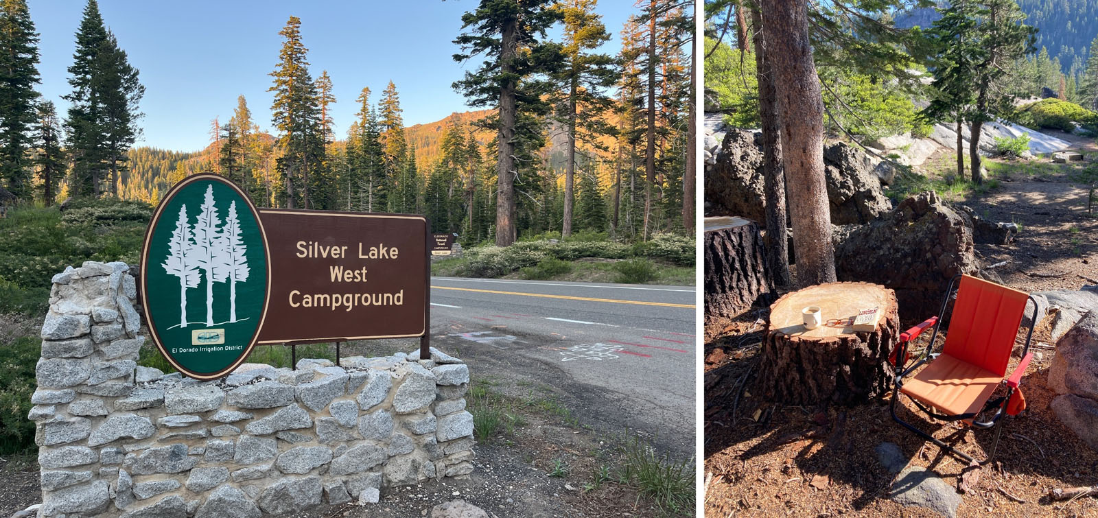
With temperatures forecast to be 10 degrees cooler at Silver Lake, the decision was an easy one—I’d shift my trip-planning from Kennedy Meadows to Silver Lake West, the campground recommended by our friend. Like the Kennedy Meadows campgrounds, Silver Lake West is also a first-come-first-serve facility, meaning no reservations are possible. We’d just have to show up and hope to find an open site on a summer evening.

Alameda Post - a view of Shealor Lake
Our first full day’s hike was to the Shealor Lakes, the largest of which is seen here. This is a good, short hike that packs a punch of great scenery. At only three miles roundtrip and 650 feet of elevation gain, this was a good warmup hike. Pristine alpine lakes, lots of Sierra granite, great views, and ancient Juniper trees make this hike a winner. Photo by Steve Gorman.
Alameda Post - a large Juniper tree
I stopped to appreciate this ancient Sierra juniper tree, some of which can grow to 80 feet tall and live for thousands of years. It is a real treat to be in the presence of these ancient giants that have been here long before our civilization and may be here long after. The Juniperus grandis is known as the Sierra juniper or Western juniper. Photo by Steve Gorman.
Alameda Post - a woman looks out over a scenic mountain view
Edie stops to take in the view on the Thunder Mountain Trail, one of the great and challenging trails in this area. The trail borders the Kirkwood Ski Resort, as well as the Mokelumne Wilderness, and features an eight-mile round trip hike with 1,883 feet of elevation gain. It took us six hours to complete the hike, but that was with a lot of stops to take photos, and a long lunch break at the summit. Fast hikers could do it in four hours. Photo by Steve Gorman.
Alameda Post - two people smile for the camera with a scenic view in the background, including a lake
I used my camera with a tripod and self-timer to take our picture atop Thunder Mountain, elevation 9,400 feet. It was a pretty challenging hike to get up here, but like all mountain summits, the view is always worth the effort. And the views all along the way were spectacular. Photo by Steve Gorman.

Rush hour departure

The trip was scheduled for Wednesday to Saturday, but in order to have four nights and three full days of hiking in the area, we decided to leave on a Tuesday afternoon, after my wife Edie got home from work. Heading east from the Bay Area at 3 p.m. on a weekday meant we were heading into the heart of rush hour, but the advantage was that we’d wake up already at our destination on Wednesday morning. It took us four and a half hours to get to the campground, including a gas stop. That was at least an hour more than it would have taken at a less busy time, but overall the drive wasn’t too bad and we were happy to find a good selection of campsites still available when we arrived at Silver Lake West Campground.
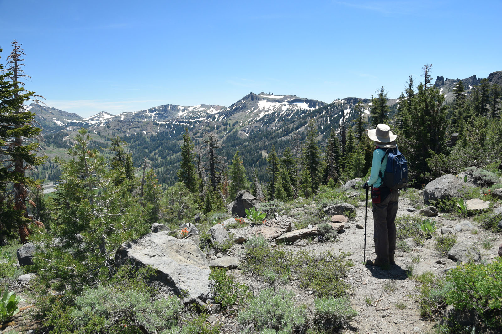
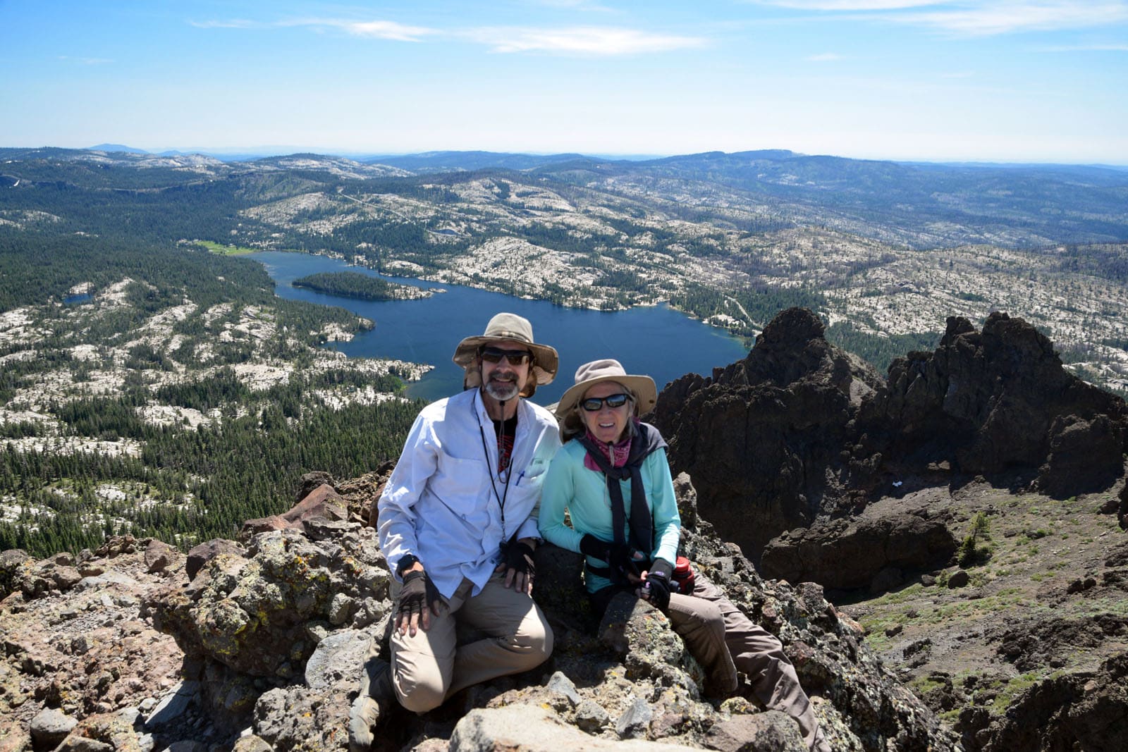
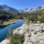
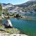
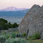
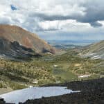
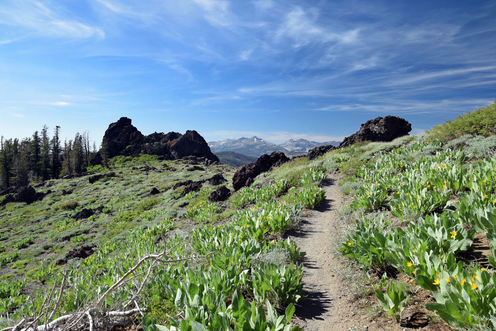
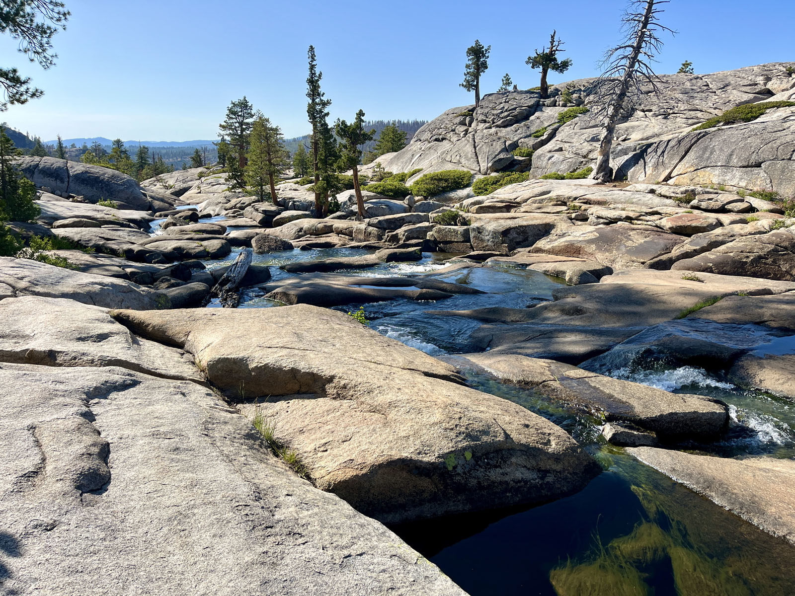
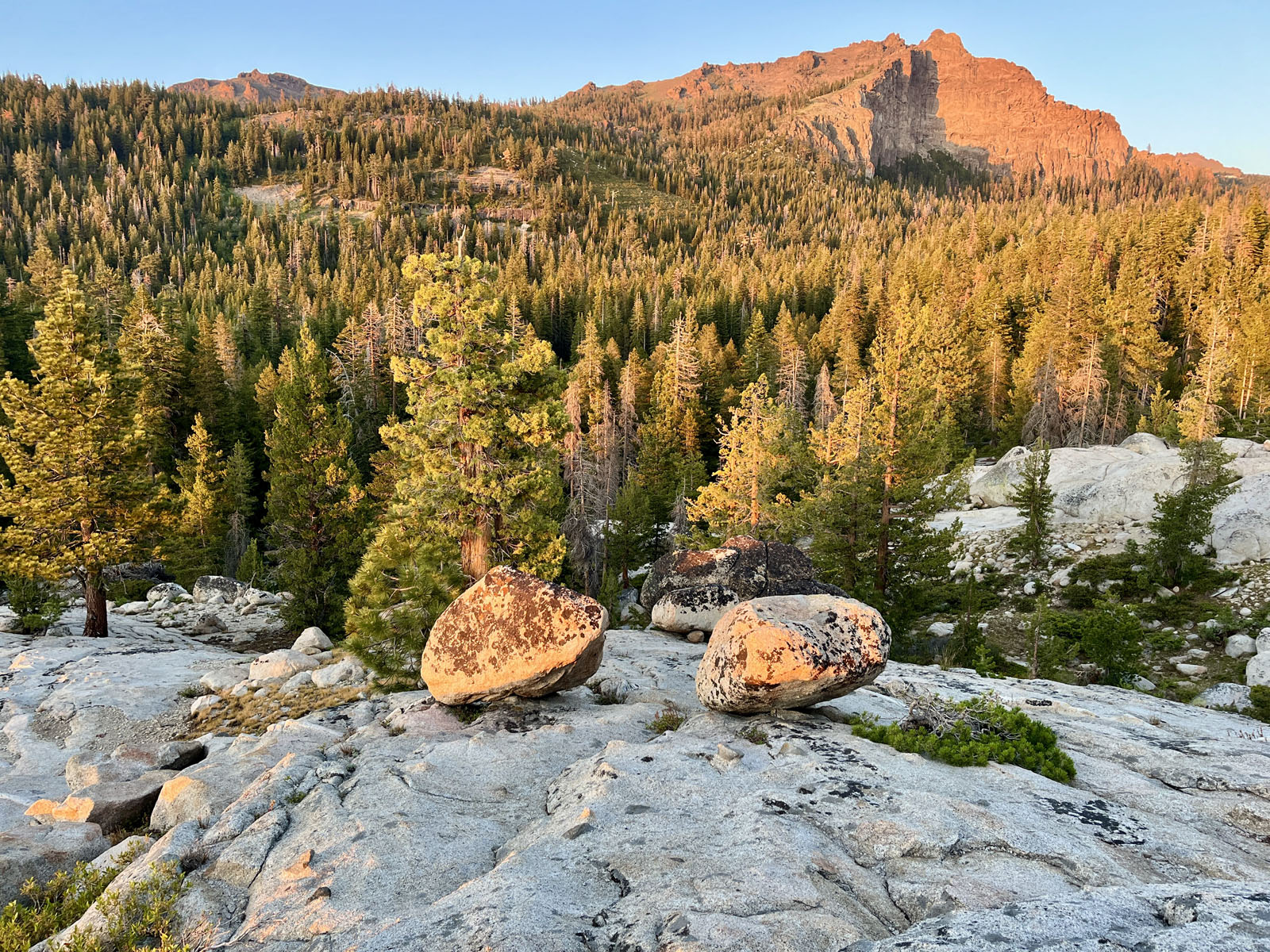
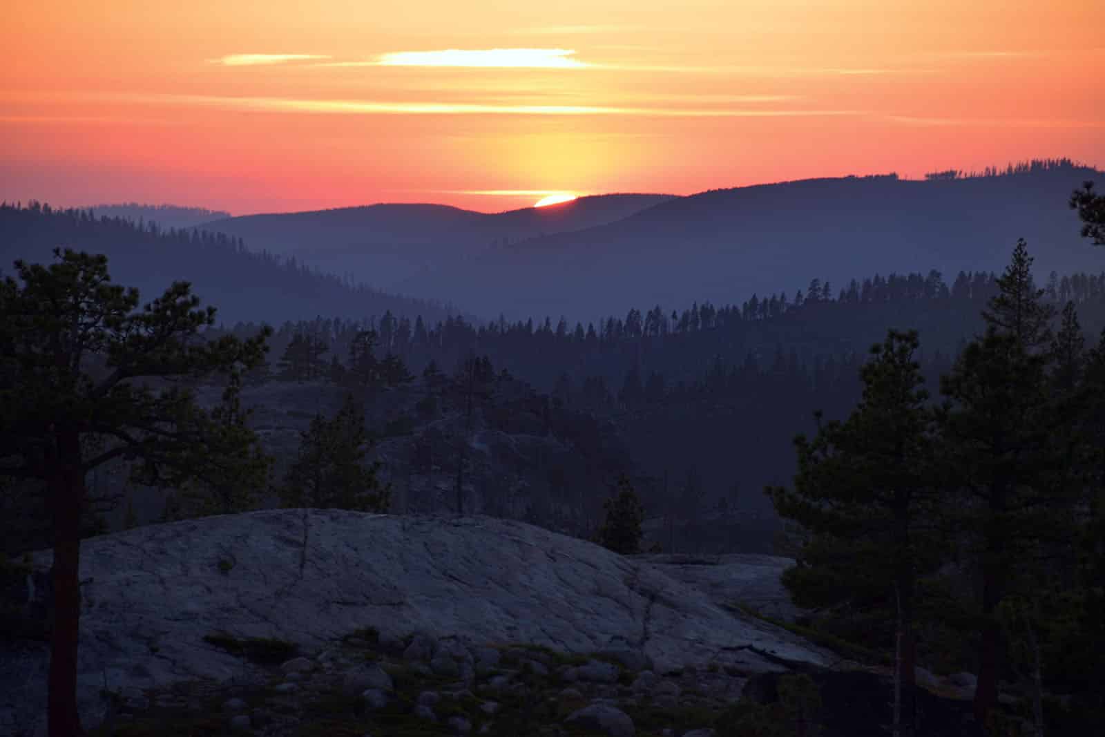
Nature abounds

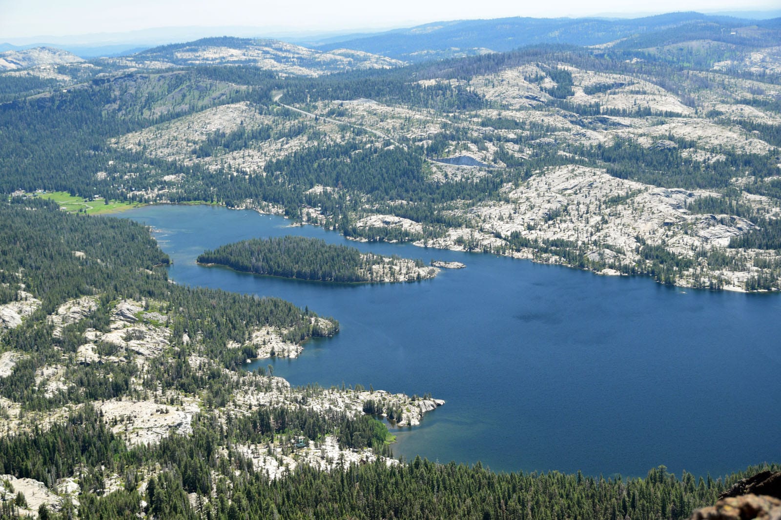
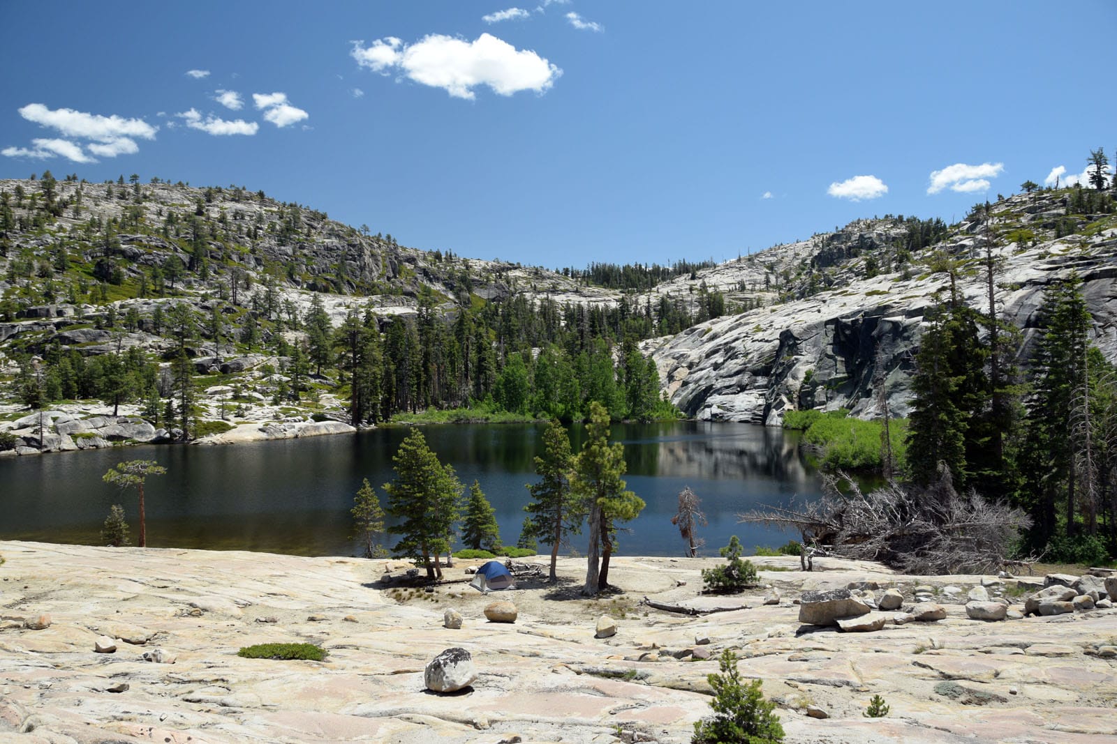
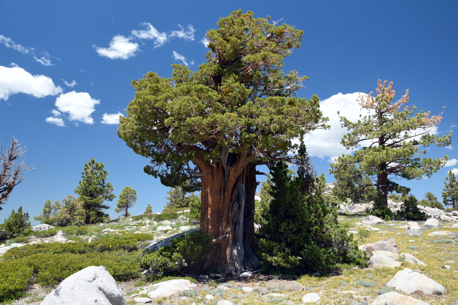
Sitting at an elevation of 7,200 feet and surrounded by higher peaks and hills, Silver Lake is the perfect base camp for exploring the area. Located in the Eldorado National Forest and bordering the Mokelumne Wilderness, there is no shortage of great hikes to choose from here. On this trip we explored four of them in-depth, leaving many more for future trips. The photos featured in this article are but a small taste of what can be experienced in this special place.

Alameda Post - a hiking trail through an open grassy area
The Kit Carson Lodge website says, “The Carson Pass area is one of the premier wildflower zones of California and one of the best hiking areas for short spectacular hikes.” This view on the Thunder Mountain Trail features a lot of Wooly mule’s ears (Wyethia mollis), while other areas feature an abundance of lupine, Indian paintbrush, Western wallflower, and many more. Photo by Steve Gorman.
Alameda post - a rocky river area with lots of indentations making small pools
One of the enjoyable and short hikes in this area leads to the “Potholes,” a series of rocky pools on the Silver Fork of the American River, where hikers can swim and cool off on a warm day. These swimming holes continue for considerable distance, with some being large enough for whole groups of swimmers, and others being as small as a bathtub. Photo by Steve Gorman.
Alameda Post - a view of Thunder Mountain at golden hour
Thunder Mountain looms over the campground and is perfectly lit by the sunset each evening. The hike to the top of the mountain can be done as an eight-mile out and back hike, or as a 12-mile loop trail. Either way, the views from the top are spectacular. Photo by Steve Gorman.
Alameda Post - a sunset seen behind a mountain
The tradition at Silver Lake West Campground is to climb up to Sunset Rock each evening to watch the sunset. From a series of granite domes and rocks on the edge of the campground, campers gather in small groups to take in this beautiful sight before slowly filing back to their campsites and campfires. Photo by Steve Gorman.

If you go:

Silver Lake West Campground is located on Highway 88, west of the Kirkwood Ski Resort. It is run by the El Dorado Irrigation District, and has 42 First-Come-First-Serve campsites. For more information, see the Silver Lake and Silver Lake West website. Please note that as of this writing, there is no potable water available at this campground. You must bring your own water for drinking, cooking, and washing. The campground fee has been reduced to $15 per night due to this lack of water. Restrooms are vault type, which don’t use water.

There is also a Silver Lake East Campground, located just across the road. It features 62 sites and is run by the National Forest Service. This campground features larger roads and sites, and would be more appropriate for RVs than Silver Lake West. For more information see the Silver Lake East website. Campsites can be reserved at Recreation.gov.

For those who prefer not to camp, the Kit Carson Lodge features rustic cabins and hotel rooms on the lake, along with a restaurant and store. Learn more and check availability at the Kit Carson Lodge website.

A good trail map of the area is the USDA Mokelumne Wilderness map, which includes the Eldorado, Humboldt-Toiyabe and Stanislaus National Forests. Available on Amazon.

Contributing writer Steve Gorman has been a resident of Alameda since 2000, when he fell in love with the history and architecture of this unique town. Contact him via [email protected]. His writing is collected at AlamedaPost.com/Steve-Gorman.

KQED Curated Content
Thanks for reading the

Nonprofit news isn’t free.

Will you take a moment to support Alameda’s only local news source?